

At the very beginning of this trip, we were introduced to the motto ‘No Bad Days in Alaska’. We were even given stickers for our vehicles that said this.
It was a lie.
There are bad days. I thought the drive from Hinton, AB to Dawson Creek was bad. Remember back on summer’s eve? It snowed! The roads were terrible. I drove in 4Hi for part of it. We slid around and we prayed and we all made it through. And we thought that would be the worst driving conditions we’d have.
Oh, the foolishness of our collective being.
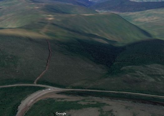
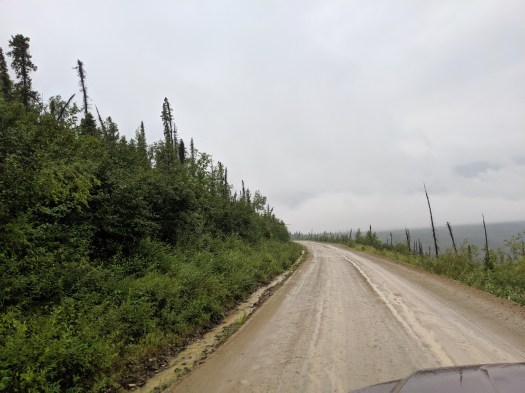
On July 1, 2019 we were due to drive the Top of the World Highway from Dawson City to Chicken, Alaska. 105 miles total. We’d finally be in Alaska! At the trip log meeting the night before the drive, Mo told us that it would be a challenge. First, we have to cross the Yukon river via a ferry: there is no bridge. Then, we would be driving on a road that is open only during the summer months. It is almost all gravel, has no shoulder or center line, has no guardrails and travels along some steep cliffs, sometimes on both sides. The border crossing is at Poker Creek, Alaska, population 3. This is the most northern international border crossing in the United States, and the highest in elevation, at 4,127 feet. Once in the USA, the road apparently just gets narrower.
Remember that I mentioned it was a mere 105 miles? Guess how long it would end up taking to get to Chicken? Guess right now to the nearest half hour. I’ll tell you at the end of the trip, below, and let me know if you were anywhere close. Hint: at the log meeting, Mo told us that the recent conditions had been good and we could expect about 35 mph.
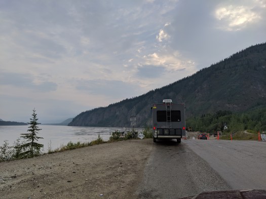
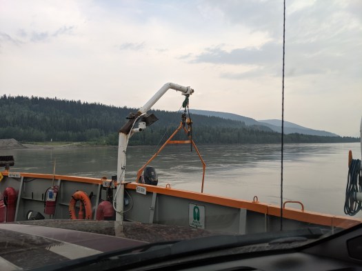
Therefore, when I thought about this drive, I was a little queasy to start out with. I was very nervous about the ferry. It only holds 2 RVs, and it’s tight. Watching it go back and forth didn’t help, plus we were crossing on Canada Day, July 1st, which probably meant that the back up people were working, at least in my mind.
Jerry and Wendy wanted to leave at 7 am. This was fine with me; I didn’t want to wait in a long line for the ferry just getting more nervous. When we got up, it was drizzling. This was good for the wildfire, but bad for the dirt/gravel road. If it’s just light drizzle, it’ll help keep the dust down, so that’s ok. But if it rains, the water will wash out more and more potholes and the trip would be miserable. If only that was the worst of our journey….
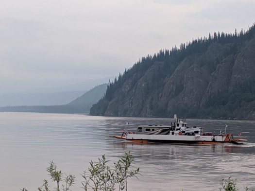
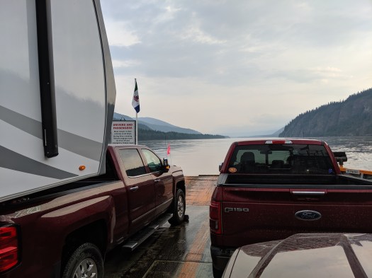
So, we left the park right on the nose at 7. There were already a few RVs in line–not with our group–and a few cars, so we had to wait a total of about 40 minutes. They did load Jerry first and then me, and it wasn’t nearly as bad as I’d expected.
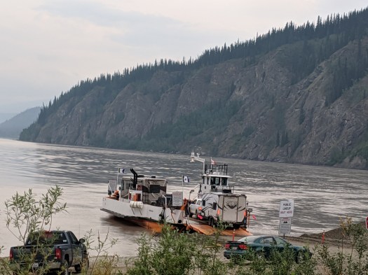
I later learned from Wendy that the male workers on the ferry were convinced I wouldn’t be able to drive my rig on correctly. I did, and the one female worker was overheard by Jerry and Wendy telling the guys “see, I told you she could do it.”
Once we unloaded without any trouble on the other side, I let out a big sigh of relief and felt a bit giddy. It hadn’t been bad at all!! I felt sure the worst was behind us, and was eager to get going.
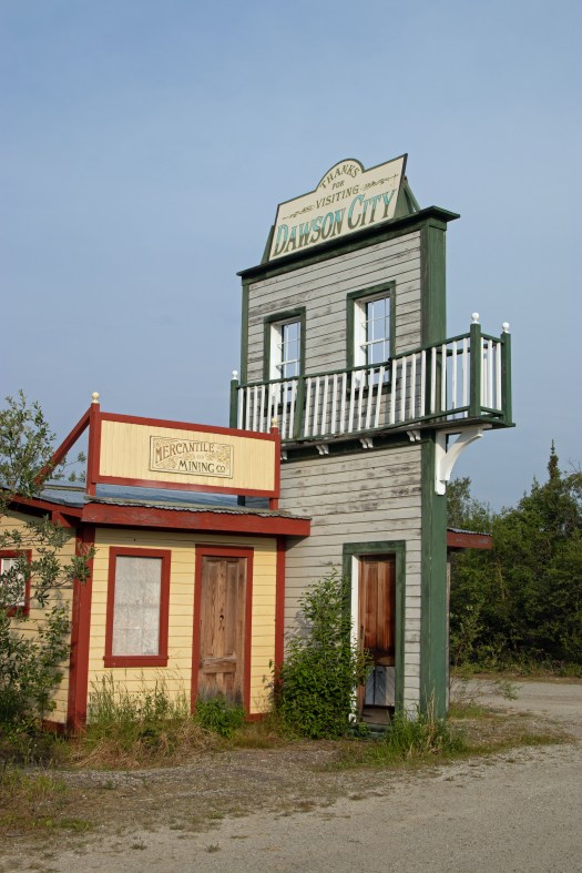
Initially, all was well. There was pavement for a few miles. We stopped at a pull out just a few miles up the road to see this interesting Dawson City display:
It had stopped raining, and I was hoping the drizzle was finished. We then left pavement behind, and I was careful to keep a good distance away from the back end of Jerry to prevent rock hits.
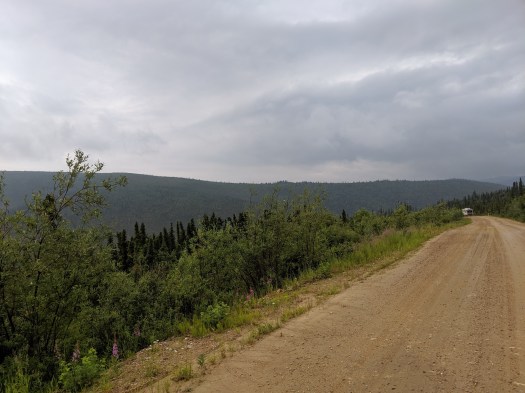
It wasn’t bad for a bit…and then, as we climbed up and up and up, it started to get…cloudy. We were literally high enough on the mountains, and the clouds low enough that we started getting what I would call patchy fog.
You’ve all probably flown in an airplane before (well, most). You know how as you climb to cruising altitude, you sometimes fly through some patchy clouds. It was like that for a bit. But, you’ve also probably experienced what it’s like to fly through solid clouds. And that, folks, is what happened next.
It was on us before we could even think about what to do. One minute, I can see Jerry and Wendy’s trailer, though it’s hazy. And then they disappeared. I could see his tail lights when he hit his brakes for a few minutes, and then even that disappeared. And I was alone on a narrow gravel road and couldn’t see much past the hood of Rory.
The one saving grace, and this was a big one, was that the border crossing is only open from 9-9 Alaska time. Which meant no one could be coming at us for a few hours–no one lives up this road, so the only traffic would be people crossing from Alaska. I tried to stick to the center, but it was so hard to see. I even rolled down my windows and stuck my head out to watch the gravel, but then, to add insult to injury, it started raining.

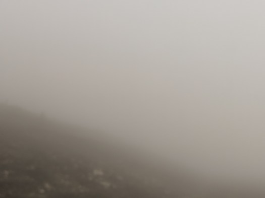

Honestly, we shouldn’t have been driving. If I’d been by myself, I wouldn’t have made it. It was that bad. There were occasional pull outs–I’d have probably stopped at one and just parked it for a day or so until conditions improved. But, Jerry and Wendy were in front of me somewhere, which gave me some comfort. Jerry has a Go Pro and uploaded a few minutes of footage to Youtube. You’ll hear me say I can only see him when he flashes his brakes, so the footage is near the beginning of the cloud bank. And, I was still somewhat laughing and joking around. That would all end shortly, but in the meantime, go watch the video here.
If the worst of my day were driving in this cloud/fog, it would have been a pretty bad day. Yet, it was about to get worse again.
Remember I’d lost sight of Jerry and Wendy completely? Well, I did have my Google maps running with the route highlighted. I’m not sure why, as there was only the Top of the World to go on, but it helped a bit knowing where a curve was, etc. Especially in the fog. Then, I came to this area:
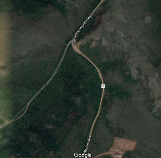
I was approaching from the top of the map and, if all had gone well, would have kept going to the bottom. However, Google maps on my display was showing the map not from north to south, but driving from right to left. It was really hard to tell from the map standpoint which road I was supposed to be on at this junction, as the GPS this far north is not always spot on. Frequently, I’ll be driving on the only road for miles around and the Google gps has my position several spaces above or below the only road. So, I wasn’t sure which road to take and Jerry and Wendy were nowhere to be found.
This area is also quite a wide stretch, though in the dense cloud that was also very difficult to see.
It turns out this was a large pull out as well, though I had no idea this was the case. It was just empty and confusing road to me. Now, many of you know that I worked Pediatric Critical Care for ten years. I was the medical director for a pediatric ICU that catered to trauma for some of those years. I have run hundreds of codes. I am calm and decisive, directing the resuscitation team in an organized fashion. I do not panic–at least not externally.
But, alone, blind on a gravel road, no cell service, with a GPS that I wasn’t sure was correct, I LOST. MY. MIND.
I grabbed my radio, hit the mike button and said something like “I’mlostIdon’tknowwheretogo. Helpmesomeone.”
“Idon’tknowwhichroadtotake”
“Idon’tknowwheretogo!!!!!!!!!!”
Then I hear Jerry say, “who is this?”
Later, I learned that Wendy told him she thought it was me. He told her “no, that’s a little girl. She sounds like she’s eight.”
He actually thought some little kid was in the vicinity (how, I don’t know in that forsaken land) and was playing on the radio.
“It’smeAndrea. Idon’tknowwheretogo!!!”
“Andrea?” with a lot of surprise in his voice.
“YES,helpme!!!!!!!”
Now, looking back I could have just waited for someone to come along behind me. We’d left so early that almost everyone in the group would be along behind us eventually. But when you’re in full panic mode, you don’t think rationally. I could have gotten out of the truck and walked along both roads for a stretch to see if one looked more top of the worldish than the other–again, didn’t think of that in the moment. I just knew I was being left behind in the middle of nowhere and couldn’t see a dang thing.
Jerry eventually got over his shock and believed it was me. I moved forward slowly (well, with the cloud that was all I could do) and got back on the right path. And that, my friends, is how I got lost in a pull out. It’s become somewhat legend for the group.
I did eventually catch up to Jerry and Wendy maybe a mile or two later–they waited for me. Jerry gently suggested that I stick closer to their rear than I had been, and from then on I was so close Rory could have been pulled by them.
The clouds were a bit better by the time we got to Poker Creek. We waited about 20 minutes to cross the border. The Border Agent was from Kentucky and gave me a hard time about my Indiana license plate; I told him a couple from Kentucky was behind me. Later I learned that when Randy and Mary pulled up, he came up to them with a very serious face and said, “I have just one question. Do you bleed blue?” They then talked to him for like 15 minutes; he told them an Indiana person had ratted them out, so they gave me a hard time about it. Definitely a very fun guy, which you rarely find in border agents.

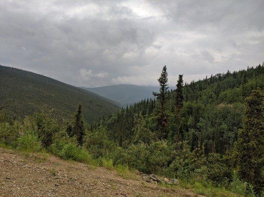
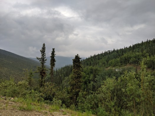
We were finally in Alaska! I have few pictures; it was still raining. There was beautiful pavement for like 20 miles, then it disappeared into a mud/gravel mixture. However, I could see again. The clouds weren’t so heavy.
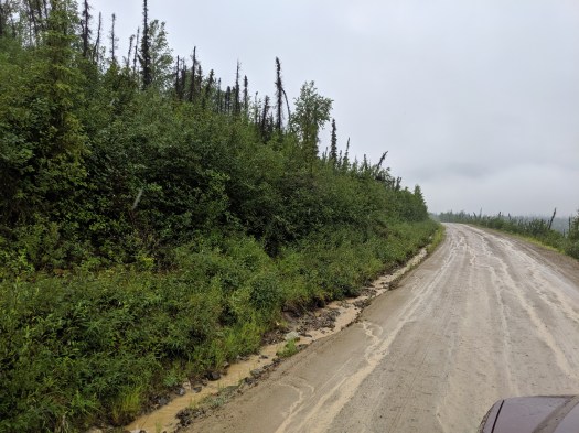
The road was much narrower, and the mud a bit slippery. Randy and Mary later told me they could see my trailer sliding around, though I didn’t notice it.
After a SEVEN HOUR drive, 105.3 miles and an average miles per gallon of 7.9, I arrived in Chicken. Mo and Sally had told us we’d be having walking tacos and margaritas that night. I was wondering why we weren’t handed a margarita as we pulled into our spot. I got out, and as others pulled in we hugged each other and thanked heaven we’d made it.
Then, we found out not all of us escaped unscathed. Bob G., of the can can dancing previously, had come off the road into a ditch. He was trying to let someone go by in the other direction and the muddy right side of the road collapsed, sending him down. He and Marshall and Ivy were shaken up, but ok. The incident happened in Alaska, about 10 miles from Chicken.
Now, I will tell you that I hadn’t eaten much of anything most of the day. When the margaritas did start flowing, I had my share. That was about the only redeeming spot of the entire day. I did do some fun things in Chicken, but I’ll save them for the next day’s post. Chicken deserves the credit, it’s a quirky little place.
So, the new motto is “mostly no bad days Alaska.” And we survived. I drove the Top of the World highway on July 1, 2019 and lived to tell you the story.

You are amazing.
LikeLike
Holy crimeny, that sounds awful! But you persevered and made it through and I’m glad you did!
LikeLiked by 1 person
Me too!
LikeLike
Wow! Even the pictures of that stretch of road are kinda scary! Glad you got through and finally reached Alaska. Now the adventure can begin!?!
LikeLiked by 1 person
Absolutely!
LikeLike
Yikes! what a nerve racking experience! Glad you made it safely!
LikeLiked by 1 person
Thank you!
LikeLike
I was nervous just reading ! Could not even imagine my own reactions. You did a great job, safe and with great accomplishment. Beautiful sights ahead on your amazing journey. We will be here waiting for your next post. Our ❤️ To you and your group. Enjoy, relax and remember we are always thinking of all of you!
LikeLiked by 1 person
Thanks for following!
LikeLike
Wow great story! I could feel myself on the edge of the cliff as you described your drive in the clouds!
LikeLiked by 1 person
It was harrowing, for sure.
LikeLike
Wow, what a scary thing to have happen, I almost need a marguerita just reading about it, hopefully the rest of the days will be good ones, your blog is very entertaining, you should write a book about this trip when you get back. Sure enjoy the beautiful pics. How do you think your mom would have liked that mountain road?
LikeLiked by 1 person
I think mom would have bailed long before that road. But she might not have minded as much if she couldn’t see the sheer drops…
LikeLike
My guess at the beginning of your story was 6.5 hours. 🙂 This definitely qualifies as a terrible, horrible, no good, very bad day! I was stressed out and yet completely entranced reading about it. So glad to know Bob’s rig is ok to go on-I imagine the accident put a dark mark on the trip for him. Here’s hoping to only happy, amazing, breathtaking Alaska days from here on out!
LikeLiked by 1 person